Rail (750Wh) Quick review of Kiox 300 Navi & Komoot

JP-NZ

E*POWAH Elite
Feb 17, 2022
1,035
780
Christchurch - New Zealand
Just wanted to post some quick thoughts here on the upgraded navigation on the Kiox 300 with the latest firmware (app 1.12.5 April 23).

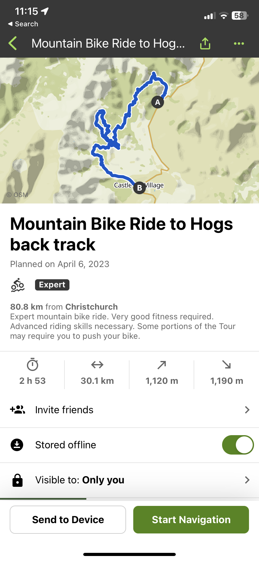
Last weekend I was heading away to an area I had never rode in and I was riding by myself. I wanted to plan my route and use the Navigation. I had never even heard of Komoot before, so I downloaded from the app store (iOS) and planned out my route. All went fine and my route came out exactly as I had planned within the app.

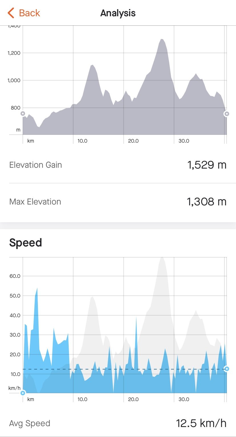
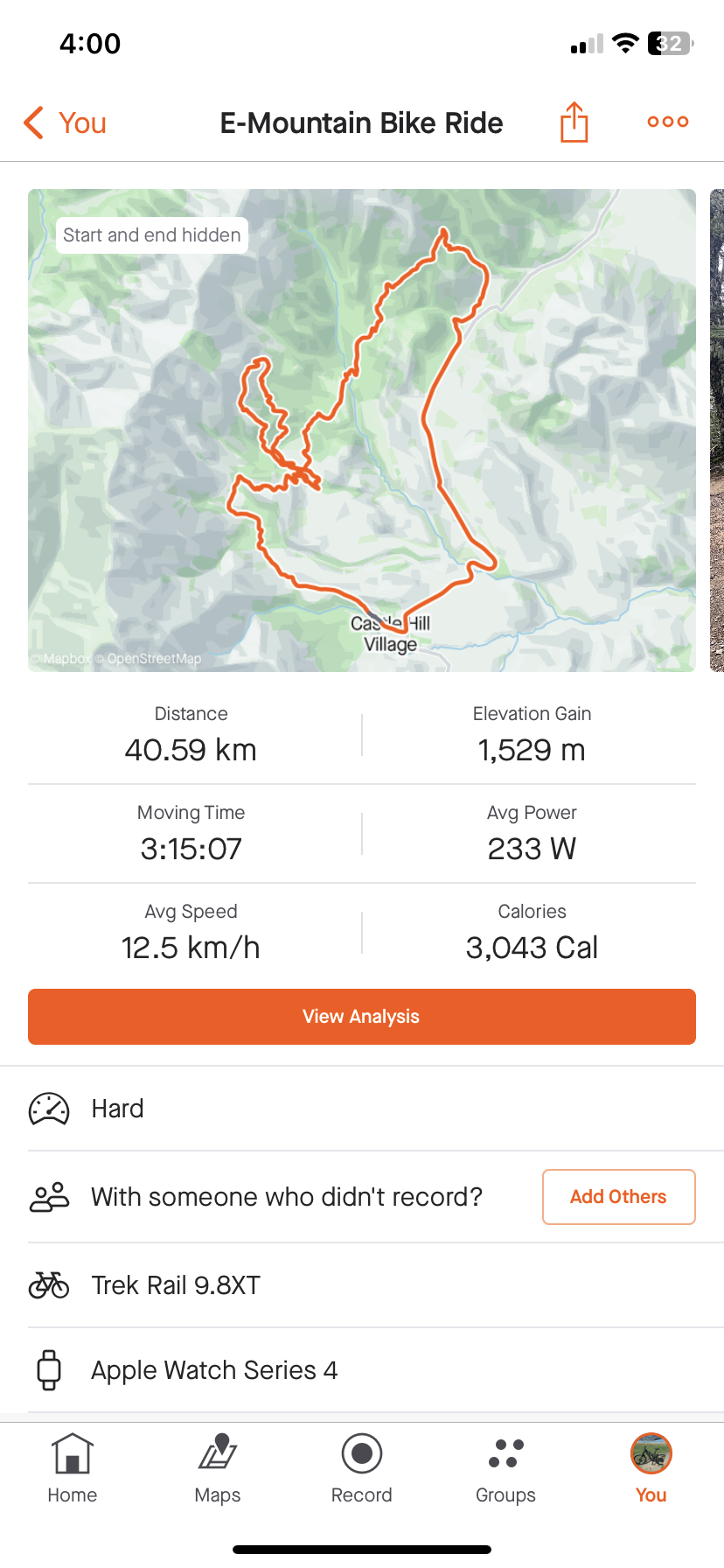
I downloaded it "available as offline" as I wasn't sure what cell coverage would be like. Got to the trailhead and sent the route to the Kiox 300. It uploaded fine and showed in layman's terms the route to follow. Now granted this isn't the flashiest interface with only a white trail line on black screen but it still showed me the junctions and turns to take. It also alerts you when your "off trail" which is handy. It also gave me advance warnings in metres when turns were needed in forks/junctions etc. On the strava below obviously I rode on the Road from B to A on the Kommot, didnt need Navi for that :LOL:

I won't use it often as I ride in local areas 95% of the time but its very nice knowing its there if I need it.
3ABAD871-EDC3-431E-B0A0-AC86278D5312.png 5244316D-BDF1-40F8-9C70-3F2255609383.png 15B466B1-F1CC-4665-9551-7941C0AB3469.jpeg
 
Last edited:

Bummers

Active member
Mar 12, 2022
528
486
UK
I'll have to try the new update, when it first came out it was terrible, unless you were on actual roads it was unusable.
 

Bummers

Active member
Mar 12, 2022
528
486
UK
You need to use Komoot if you want off road trails. That top pic within Komoot shows a route that is completely off road and walking/MTB only
I did. The kiox was a joke trying to display the route.

Fine if you're on a road but off road it was hopeless. Couldn't tell which track we were supposed to take.
 

Mikerb

E*POWAH Elite World Champion
May 16, 2019
6,145
4,676
Weymouth
Great....I have not tried that yet, but I have used Komoot on my phone before when riding in a strange to me area. ( I used it in the Brecons/S Wales and Peak District/UK) . I used blutooth mini ear phones and just relied on the voice commands.....................and it was very good even on heathland covered in spurious rabbit trails!! As you said Komoot tells you if you have gone off track and that is the only time I would then refer to the map on the phone. So I assume Kiox gives a visual alert that you have gone off track?? Does it tell you how to get back on the right track?? With Komoot on the phone the map shows the planned route ridden as a solid line and any distance ridden off track as a dotted line............so you can easilly see how to backtrack.
The only slight difficulty I had was when the planned route had a fork in it and it was not clear which direction was straight on and which was a turn. I learned to get my riding buddy to stay at the fork whist I slected one of the trail options and waited to hear if I was told I had gone offtrack or not. Assuming I got no alert I had picked the right option so could call my mate to follow.
ps I paid a one off fee that gives me worlwide map coverage so do not need to be online.
 

JP-NZ

E*POWAH Elite
Feb 17, 2022
1,035
780
Christchurch - New Zealand
Great....I have not tried that yet, but I have used Komoot on my phone before when riding in a strange to me area. ( I used it in the Brecons/S Wales and Peak District/UK) . I used blutooth mini ear phones and just relied on the voice commands.....................and it was very good even on heathland covered in spurious rabbit trails!! As you said Komoot tells you if you have gone off track and that is the only time I would then refer to the map on the phone. So I assume Kiox gives a visual alert that you have gone off track?? Does it tell you how to get back on the right track?? With Komoot on the phone the map shows the planned route ridden as a solid line and any distance ridden off track as a dotted line............so you can easilly see how to backtrack.
The only slight difficulty I had was when the planned route had a fork in it and it was not clear which direction was straight on and which was a turn. I learned to get my riding buddy to stay at the fork whist I slected one of the trail options and waited to hear if I was told I had gone offtrack or not. Assuming I got no alert I had picked the right option so could call my mate to follow.
ps I paid a one off fee that gives me worlwide map coverage so do not need to be online.
I only went off track once but it tells you on the Kiox your "off route" I didnt go very far so unsure if it shows a dotted line or not? I suppose worst case scenario you could always refer to the phone?

When junctions were coming up it does display Left turn in 50m or similar as you get close to a junction but to be honest I was watching the muddy slippery trail a lot more than I was the Kiox haha.

Yes its just the same solid white line, with not much detail on the Kiox but hey its better than nothing right?
 
Feb 27, 2023
123
272
Teesside UK
I tried a route on the Kiox and when I set off it said I had completed the route. I have therefore gone back to my trusty Wahoo for GPS and attached it to the top tube to avoid having more stuff on the bars.
Screenshot_20230522_123007_Gallery.jpg
 

Mikerb

E*POWAH Elite World Champion
May 16, 2019
6,145
4,676
Weymouth
I tried a route on the Kiox and when I set off it said I had completed the route. I have therefore gone back to my trusty Wahoo for GPS and attached it to the top tube to avoid having more stuff on the bars. View attachment 115433
you have Kiox...not Kiox300. If you import a route you have to designate it "point to point" or circular. A circular route will start and finish in the same place so the direction of travel shows the out route v the in route.
 

EMTB Forums

Since 2018

The World's largest electric mountain bike community.

523K
Messages
25,845
Members
Join Our Community

Latest articles


Top