Pic of the Day

Absolute blinder of an adventure ride today. Getting lost on the moor, getting stuck in sludge and finding new places. EPIC
IMG_20241112_111606001.jpg
IMG_20241112_111550856.jpg
IMG_20241112_111847005.jpg
 
⚡ EMTB Pro Go Pro — Living Intelligence Reports, exclusive discounts & ad-free Up to 25% off Peaty's, PEMBREE, Magicshine & more · Ad-free browsing · Pro badge See the deals →
It’s been a few weeks now since the atmospheric river(s) have hit our area. The network of trails(70+) have basically survived on Burke Mountian but some of the access and fire roads did not. Half of this mountain is cut off to Mountian biking.

IMG_8328.jpeg

Foot and MTB traffic has been significantly reduced. However, some of the lower trails are being improved while some volunteers wait for better access.

IMG_8329.jpeg
“Bullet Tooth Tony” (short trail) is just one example of improvement.

This bridge will need to be rebuilt.

IMG_8331.jpeg
Some roads are still rideable.

IMG_8335.jpeg
Some are not.
The amount of rain we’ve received has been a blessing and a curse. Hopefully things will get better by spring. 👍🏻
 
Sun came out today and temp got up to 12C so decided to go out before temps drop in the next few days.

Came up here:

20241113_133223.jpg


There are 4 ways to go, decisions, decisions:

20241113_133312.jpg


Don't want to go back the same way, going right looks interesting:

20241113_133246.jpg


But the ruts lower down are 18"/45cm deep and is pedal strike city.

So could go straight ahead:

20241113_133255.jpg


But gets really narrow with a tight gate just where you need to stay on the bike

So it's left:

20241113_133300.jpg

Which leads to this trail, no frost yet so a soft carpet over the chalk and flint lurking underneath.

20241113_134658.jpg

20241113_134511.jpg


Edit: forgot to add this pic

20241113_134305.jpg
 
Last edited:
It’s been a few weeks now since the atmospheric river(s) have hit our area. The network of trails(70+) have basically survived on Burke Mountian but some of the access and fire roads did not. Half of this mountain is cut off to Mountian biking.

View attachment 150138
Foot and MTB traffic has been significantly reduced. However, some of the lower trails are being improved while some volunteers wait for better access.

View attachment 150139
“Bullet Tooth Tony” (short trail) is just one example of improvement.

This bridge will need to be rebuilt.

View attachment 150141
Some roads are still rideable.

View attachment 150142
Some are not.
The amount of rain we’ve received has been a blessing and a curse. Hopefully things will get better by spring. 👍🏻
That lad wi tje beard has an uncanny resemblance to someone I knew sadly died young.
 
Finally managed to check out a smidgen of the Dunkeld area . Not sure if these are unofficial trails but there's lots of them .
I was only exploring but the amount of serious steep rooty decents that finished on the forest road i was going up was scary , pics just can't capture the steepness. Did a wee Blue , really !!! and one Red . Full marks to the folk that cycle these. The Hermitage was well worth the visit, I'll be back.

20241113_094928.jpg 20241113_095807.jpg 20241113_100049.jpg 20241113_103224.jpg 20241113_103318.jpg 20241113_103457.jpg 20241113_110402.jpg
 
What a stunning day to be outside, although I had forgotten about that delightful combination of low sun and wet roots which caused an unscheduled dismount ( and an unscheduled lie down). But slow speed and softish landing, so all good 👍🏻View attachment 150169
Yes respect needed for the roots , dry ones are bad enough.
 
28 miles of tarmac teasing today apart from a couple of miles when I got lost and had to go cross country. Big ol building is not my house but a place called the Grange near Winchester. I just wanted to see what my bike looked like next to it before putting in an offer. My offer got turned down. 😂
IMG_4003.jpeg
IMG_4011.jpeg
IMG_4025.jpeg
IMG_4023.jpeg
 
Spring tides today the ☠️ pirate shack nearly wet at the mouth of River Spey. Mild again but weather due to change tomorrow . Dry cycling over for a few months I imagine. Surprised to see I did 30 miles won't be doing that long in the winter too cold.

20241115_121339.jpg
 
I’m still on a three week roadtrip with my family. It was 33 degrees and snowing in Mount Shasta, Ca today so it seemed like perfect weather to go on a ride. 17 miles later and I can say that the trails here are amazing. Great traction other than the occasional patch or ice or frozen pine needles
IMG_5041.jpeg
img_5042-jpeg.150329
IMG_5046.jpeg
IMG_5042.jpeg
 
Last edited:
3 Celsius / 37F, very foggy weather, but had to test my new Fox 38 out. The grip x2 definitely a big step forward, but after the fox 40, the 38 chassis feels very flimsy...


Looking down at the beautiful Budapest! :D
fog1.jpg


Leaves, leaves everywhere.....
leaves.jpg

leaves2.jpg


Our Parlameint building
parlament.jpg
 
Forest England have been out with some new signage (maybe I never noticed before?). I think the skull & crossbones is a bit OTT.

Skull.jpg


Yes, if a beginner went down there that stayed sat on the saddle and went faster than their skillset, then they might come off. There was a similar sign at the entrance to the dirt jump area. That has an introductory line with 12" high tabletops, and one next to it with 2' high table tops. But there are also lines with 8' gap jumps. The problem is that it was putting off the Mum of a family of four. The 8-year old was gung-ho for some fun, as was his Dad, but Mum was reluctant. I nearly failed to persuade her to let them give it a go. The boys loved it! :love:
 
IMG_6715.jpeg
IMG_6717.jpeg
IMG_6723.jpeg
IMG_6724.jpeg
IMG_6725.jpeg
Great trip up to glentress yesterday
trails were running pretty dry which was a total suprise was expecting a bog fest
Picture from top of spooky descent you used to be able to see hills on the other side
Now the trees are starting to grow that view is slowly disappearing
 
I think the skull & crossbones is a bit OTT.

View attachment 150416
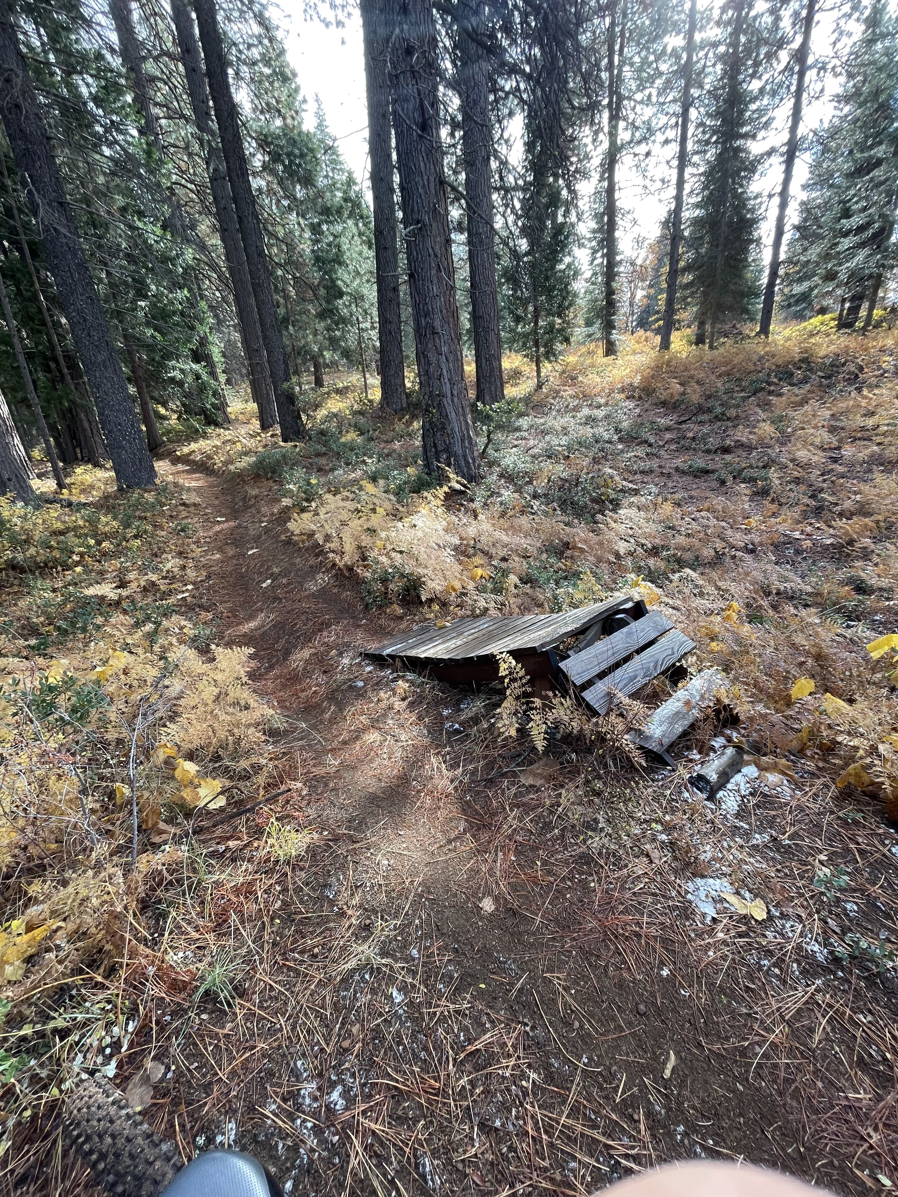
That does seem a little OTT.
In our area, green, blue, red, black diamond and double black diamond, indicates a trail difficulty. But nothing is standard.

Of the two mountains in our area, Eagle Mountain is well signed. Burke Mountian is not. Signage on Burke Mountain sometimes gets torn down as fast as it goes up.

If a trail sign built by volunteers is fixed high enough, and well enough, it may survive.


IMG_8328.jpeg74209459200__AA9C872B-07E5-44F5-90F3-3700B63AB733.jpegC12981A2-82CF-4EA7-9D7F-277C1BAF313B.jpegIMG_6525.jpegIMG_5932.jpegIMG_2820.jpeg IMG_2817.jpeg IMG_5088.jpeg IMG_5066.jpeg IMG_5062.jpeg IMG_4473.jpeg IMG_4508.jpeg IMG_4352.jpeg IMG_3370.jpeg IMG_3280.jpeg
 
Another day and another trip to Glentress..old "Reds" in the morning and then playtime in the afternoon on the new Black / Red & Blue flow trails ..which were good fun but it looks as if too many riders have ridden these and found them a little beyond their skill set by the amount of brake bumps on the red & black in particular .
A really good time was had by all and it's always great to hook up with Alan ,Ant & Wayne ..roughly about 25miles & 3,500ft..
Only the one pic at the start of Spooky Wood descent ..with two Smoggies from Middlesbrough ( canny craic) to the left of the pic ..Ant, Alan & Wayne to the right..
1000008930.jpg
 
Last edited:
Keep reading
    Browse all

    Similar Threads

    Community Stats

    Since 2018
    670K
    Messages
    41,108
    Members
    Join 30,000+ Riders, it's free!
    Back
    Top